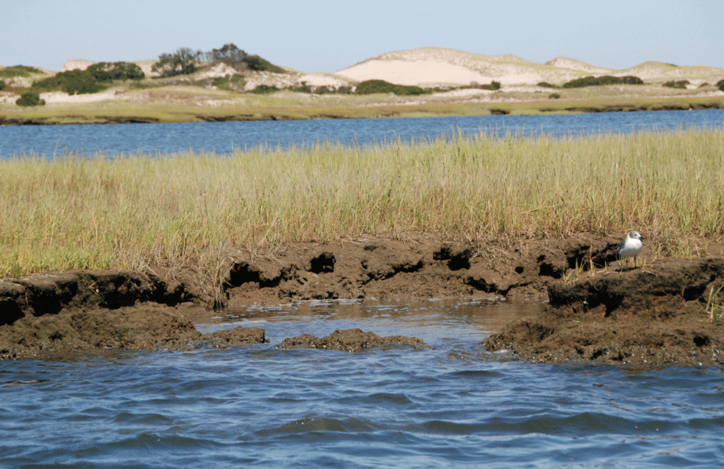
Salt marshes are an important life source for Barnstable Harbor. These coastal wetlands that are flooded and drained by salt water brought in by the tides. They are marshy because the soil may be composed of deep mud and peat. Peat is made of decomposing plant matter that is often several feet thick. Peat is waterlogged, root-filled, and very spongy.
Barnstable Harbor is surrounded by hundreds of acres of salt marsh
Salt marshes are frequently submerged by the tides and contain a lot of decomposing plant material. Low oxygen levels in the peat—a condition called hypoxia is caused by the growth of bacteria which produce the sulfurous rotten-egg smell that is often associated with marshes and mud flats.
These intertidal habitats are essential for healthy fisheries as they provide essential food, refuge, or nursery habitat for many fisheries species, including shrimp, blue crab, and many finfish.
Salt marshes also protect shorelines from erosion by buffering wave action and trapping sediments. They reduce flooding by slowing and absorbing rainwater and protect water quality by filtering runoff, and by metabolizing excess nutrients. They are integral to long term coastal resilience as they grow and migrate inland. Coastal land acquisition is an important element in allowing this growth in the face of rising sea levels.
Here is a PDF linking to the Redfield Marsh Study conducted in Barnstable Harbor in 1972:
Salt Marshes: Ditches, Drainages, & Sea Level Rise
On March 10, 2021, we hosted a virtual event on Zoom with USGS Research Scientist Meagan Eagle. The presentation was titled: Salt Marshes -Ditches, Drainage, & Sea Level Rise.
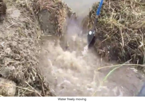
Meagan shared her study on the impact of mosquito control drainage ditches upon the elevation of Barnstable Harbor’s Great Marsh system. The study discovered that the ditches accelerate drainage causing the sediment to lost moisture. This moisture loss allows the sediment to dry out, no longer forming the waterlogged peat that can preserve roots and other organic components for hundreds of years. The result is erosion and lower marsh elevations. In the face of predicted sea level rise, this could lead to the “drowning” of the marsh.
Further, she introduced an important tool for gauging impacts of Sea Level Rise on various marsh situations. This is a video introducing the Marsh Sustainability & Hydrology Tool. The video features some beautiful drone videography of Barnstable’s Great Marsh.
Here’s a link to the tool & the Great Barnstable Marsh Case Study.
In a post-presentation Q & A, a participant asked about Marsh Migration -the ability of a marsh to shift gradually inland onto formerly dry land. Meagan responded citing Sean Duffy‘s study on the Sandy Neck Barrier Beach System Area. Click the link below to see that study.
sandy-neck-acec-crossing-assessment-2019
This study indicates that areas of “tidal restrictions” are the points where the marsh wants to migrate. Lower level areas/tidal crossings on the south side of Barnstable Harbor are the paths for marsh migration. Tidal restrictions such as culverts and bridges can slow down this migration.
Finally, nitrogen loading of the marsh is most destructive in the form of lawn fertilizer on areas adjacent to the marsh.
For more information on the impacts of eutrophication on the marsh, here is some more information:
 Coastal Eutrophication as a Driver of Salt Marsh Loss
Not All Nitrogen is Created Equal
Mosquito Control Ditching Drains:
Mosquito control by ditching drains standing water off of coastal wetlands to reduce the natal habitat for mosquito larvae while simultaneously allowing aquatic predators of mosquito larvae to access their prey. Mosquito ditches were widely installed in tidal wetlands in the eastern United States in the 1930s, when Depression-era work relief programs were assigned the task. In New England, over 90 % of salt marshes have mosquito ditches.


